

Cold WXR Altitude Correction app for iPhone and iPad
Developer: Ralf Keber
First release : 13 May 2015
App size: 14.16 Mb
Cold Weather Altitude Correction is a tool for visualizing and calculating approaches at low temperatures.
In addition you will find a decoder for METAR RWY Reports.
The calculation is based on ICAO PANS OPS Doc 8168.
It uses a more accurate method as the well-known 4 per correction, which becomes imprecise for temperatures below -15°C.
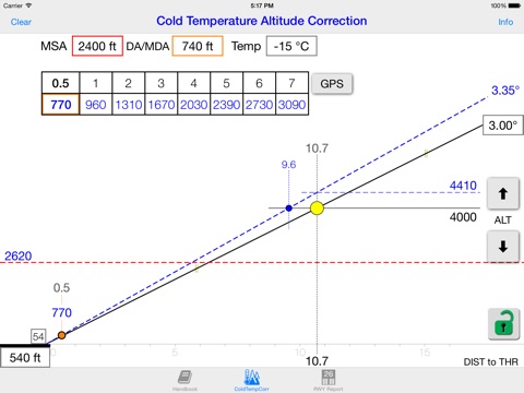
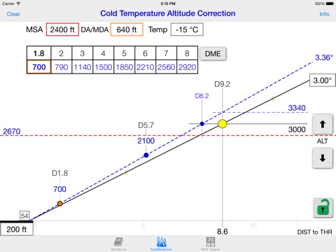
Conventional tools are calculating only a list of temperature corrected altitudes. This tool is designed more closely to a real approach. Corrected altitudes are presented in a graphical interface. A table of distances with related corrected altitudes can be calculated.
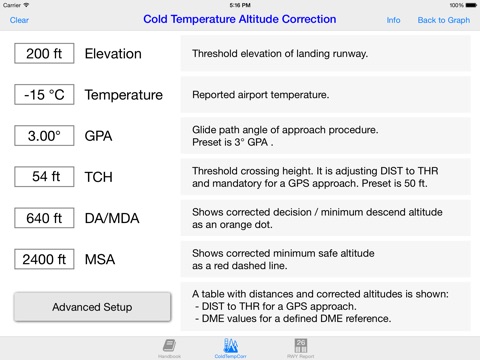
With only field elevation and temperature a graphic layout will be shown:
- glide path down to the runway
- corrected MSA
- corrected MDA
- corrected GPA
- corrected custom ALT
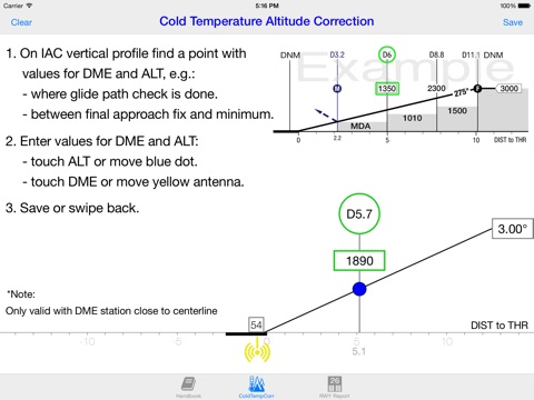
Moving a yellow dot along the glide path down to the runway will show any corrected altitudes with their related distances to threshold or to a DME station.
Distance - Altitude Table:
A table with distance and corrected altitude can be calculated.
This table is similar to the distance / altitude tables known from instrument approach charts, but it will show corrected altitudes.
You can choose between an approach type based on "distance to threshold" (GPS) or based on a defined DME station.
A handbook is included in the app itself.
For night operations you can switch to dark mode.